Pages Menu
TwitterFacebook
Categories Menu

News & Updates

“Mother of all Philippine Maps” now immortalized on a postage stamp

Posted by on Mar 16, 2021 in Featured | Comments Off on “Mother of all Philippine Maps” now immortalized on a postage stamp

“Mother of all Philippine Maps” now immortalized on a postage stamp

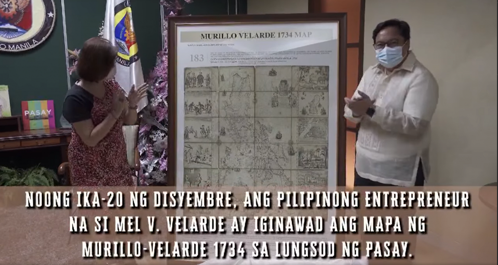
One does not need to be a stamp collector to appreciate the new postage stamp unveiled by the Philippine Postal Corporation (PHLPost), which features the “Mother of all Philippine Maps.” The first scientific map of the Philippines, the “Carta Hydrographica y Chorographica de las Yslas Filipinas Manila 1734,” also known as the Murillo Velarde 1734 Map was prepared by Spanish Jesuit cartographer Father Pedro Murillo Velarde together with two Filipinos–engraver Francisco Suarez and artist Nicolas dela Cruz Bagay. It was acquired by Mel Velasco Velarde, Chairman of the Asian Institute of Journalism and Communication (AIJC) and the NOW Group, through a Sotheby’s auction in London in 2014. Velarde donated the map to the Philippine government through a deed of donation. Now, citizens can get their hands on this significant artifact in the form of a stamp. On March 16, PHLPost honored Philippine history and heritage through the launch of the stamp featuring the Murillo Velarde 1734 Map. It was held at the Philippine Postal Corporation Building in Liwasang Bonifacio, Manila. Hon. Norman N. Fulgencio, Postmaster General and CEO of PHLPost, expressed his appreciation to the Velarde family: “We are honored to be given by the Velarde family the opportunity to issue this souvenir sheet.” He said the launch of the stamp was organized in commemoration of the 500th anniversary of the Philippines’ role in the first circumnavigation of the world. In his message during the ceremony, Velarde thanked PHLPost for bringing the map closer to the Filipino people. He added, “Today, PHLPost is telling the world that we are one nation deserving of our self-worth and respect, for we are evolving as cultural leaders of this blossoming single global community of man.” The Murillo Velarde 1734 Map stamp was presented to the Velarde family during the ceremony. Accepting the plaque were Velarde, Vivian F. Salinas, and their 3-month-old baby, Victor Chriscien S. Velarde. The Murillo Velarde 1734 Map shows the entire Philippine archipelago. It is flanked by two pasted-on side-panels with 12 engravings—intricate illustrations of the early Filipino people and their way of life during the 18th century. The map was cited as evidence in the maritime case at the UN Arbitral Tribunal under the UN Convention on the Law of the Sea (UNCLOS). It may be used as a visual representation of the country’s sovereign territorial rights. Launch of the Murillo Velarde 1734 Map Postage Stamp, 16 March 2021 Hon. Norman N. Fulgencio, Postmaster General and CEO of PHLPost, and his wife Cherry DC. Fulgencio present the Murillo Velarde 1734 Map stamp to the Velarde family, who gave permission to PHLPost to reprint the map into stamps. Accepting the plaque were Mel Velasco Velarde, Vivian F. Salinas, and their 3-month-old baby, Victor Chriscien S. Velarde.   Postage stamp featuring the Murillo Velarde 1734 Map, the “Mother of all Philippine Maps”   Mel Velasco Velarde, Chairman of the Asian Institute of Journalism and Communication (AIJC) and the NOW Group Unveiling of the postage stamp featuring the Murillo Velarde 1734 Map, March 16, 2021 (Left to right) Maximo C. Sta. Maria III, Asst. Postmaster General for Management Support Services; Mel Velasco Velarde, Chairman of the Asian Institute of Journalism and Communication (AIJC) and the NOW Group; Hon. Norman N. Fulgencio, Postmaster General and CEO of PHLPost; Engr. Joel L. Zamudio,Asst....

read more

Manila to London and back: The story of a map’s travels

Posted by on Nov 16, 2020 in Uncategorized | Comments Off on Manila to London and back: The story of a map’s travels

Manila to London and back: The story of a map’s travels

The journey of the mother of all Philippine maps back home began four years ago   In 2014, an information technology entrepreneur was on the phone bidding in an auction in London, England, more than 10,700 km. away from Manila. Eventually, he won the bid for the 1734 Murillo Velarde map or the Carta Hydrogaphica y Chronographica de las Islas Filipinas, an heirloom of the 12th Duke of Northumberland, Ralph Percy. After winning the map at the London Sotheby’s, Velarde sent a copy to the team that would argue before the Permanent Court of Arbitration (PCA) at The Hague in the Netherlands on the Philippines’ claim on the South China Sea. The team included Supreme Court associate Justice Antonio T. Carpio The 1734 Murillo Velarde map played a crucial role in winning the Philippines’ case against China’s claim over the South China Sea (West Philippine Sea). This was on July 12, 2016. (see Map rights wrongs: the 1734 Murillo Velarde map). The Philippines now has in its public collections the country’s first and most important scientific map, thanks to the benevolence of Mel Velarde, who donated to the National Museum the map he bought at London Sotheby’s for US$273,000 (P12 million). How did the Murillo Velarde map of 1734 end up in the United Kingdom? An official map of the Spanish empire, it was commissioned by Philippine Governor General Fernando Valdes y Tamon (1729-1739) and was designed by Jesuit priest Pedro Murillo Velarde, drawn by Francisco Suarez and engraved by Nicolas dela Cruz Bagay in eight copper plates. Madee in Manila, the map shows the maritime routes from Manila to Spain and to New Spain (Mexico and other Spanish territories in the New World), an important route for the Galleon Trade. In the conflict between England and France from 1756 to 1763 (known as the Seven Years War), the Philippines found itself embroiled in the battle when Spain allied itself with France. As a territory of Spain, Manila was vital to the Spanish empire and was very much on the British’ radar. Appearing in Manila Bay and taking the Spanish forces by surprise on Sept. 23, 1762, the British fleets finally captured Manila on Oct. 6, 1762 after 12 days of fighting. In less than two days, Manila’s wall was breached, its citizens raped, tortured and killed, and its treasures looted. Among the looted artifacts was the set of eight copper plates of the 1734 Murillo Velarde map. Brigadier General William Draper, the commander of the British fleets, brought these copper plates to London and donated them to Cambridge University, his alma mater. The University then ran several new prints of the map. One of these maps was acquired by the then Duke of Northumberland who brought it home at Alnwick Castle. There, it stayed for more than 200 years. Sadly, the copper plates were later melted by the British to print their admiralty charts. Lot #183. In May 2012, a huge portion of the properties of the present day Duke of Northumberland was damaged by a severe flood. Repairing the damage entailed millions of pounds. By 2014, the Duke announced the sale of family heirlooms to raise funds to cover the cost of repairs. Among those to be auctioned off at Sotheby’s was the 1734 Murillo Velarde map estimated...

read more

LIVE: Supreme Court Senior Associate Justice Antonio Carpio launches e-book on South China Sea Speakers: – Senior Associate Justice Antonio Carpio – Former Foreign Secretary Albert del Rosario – Businessman Mel Velarde, the man who brought home the “Mother of All Maps”

Posted by on Sep 30, 2020 in Blog | Comments Off on LIVE: Supreme Court Senior Associate Justice Antonio Carpio launches e-book on South China Sea Speakers: – Senior Associate Justice Antonio Carpio – Former Foreign Secretary Albert del Rosario – Businessman Mel Velarde, the man who brought home the “Mother of All Maps”

LIVE: Supreme Court Senior Associate Justice Antonio Carpio launches e-book on South China Sea Speakers: – Senior Associate Justice Antonio Carpio – Former Foreign Secretary Albert del Rosario – Businessman Mel Velarde, the man who brought home the “Mother of All Maps”

LIVE: Supreme Court Senior Associate Justice Antonio Carpio launches e-book on South China Sea Speakers: – Senior Associate Justice Antonio Carpio – Former Foreign Secretary Albert del Rosario – Businessman Mel Velarde, the man who brought home the "Mother of All Maps" Posted by Rappler on Thursday, May 4, 2017 Source:https://web.facebook.com/rapplerdotcom/videos/1599403326747111/?extid=xDIu4rcjTL280G04 Share this:TweetShare on...

read more

NAMRIA gets official replica of 1734 Murillo-Velarde Map

Posted by on Nov 11, 2019 in Blog | Comments Off on NAMRIA gets official replica of 1734 Murillo-Velarde Map

NAMRIA gets official replica of 1734 Murillo-Velarde Map

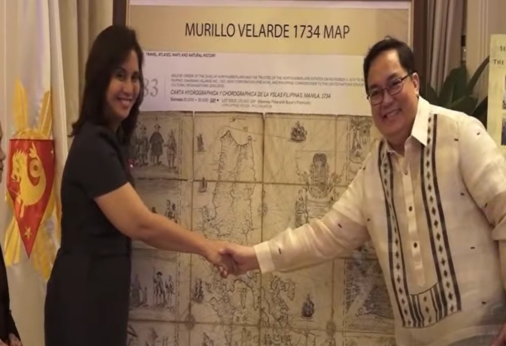
The map regarded by historians as the “mother of all Philippine maps” found its way to yet another home. On 03 October 2019, Mr. Mel V. Velarde, Filipino technology entrepreneur and educator, and Chairman and Chief Executive Officer (CEO) of the Asian Institute of Journalism and Communication (AIJC) turned over to NAMRIA, through Administrator, Usec. Peter N. Tiangco, PhD, an official replica of the Carta Hydrographica y Chorographica de las Yslas Filipinas Manila, 1734, otherwise known as the 1734 Murillo-Velarde Map. MGB Director Belen gives his welcome remarks at the start of the program. –VENER QUINTIN C. TAGUBA, JR. Mr. Velarde talks about his gift to NAMRIA in his message. –VENER QUINTIN C. TAGUBA, JR. The momentous occasion was held in the NAMRIA Boardroom and was also attended by staff from AIJC, NAMRIA Deputy Administrators Jose C. Cabanayan Jr. and Efren P. Carandang, Chief of Staff Rowena E. Bongalos, Branch Directors Ruel DM. Belen of the Mapping and Geodesy Branch (MGB), Dr. Rijaldia N. Santos of the Resource Data Analysis Branch, John Santiago F. Fabic of the Geospatial Information System Management Branch, Febrina E. Damaso of the Support Services Branch, Assistant Director John M. Labindalawa of the Hydrography Branch, other NAMRIA officials and employees. The event was hosted by Engr. Charisma Victoria D. Cayapan of MGB. The Deed of Donation is signed by Administrator Tiangco and Mr. Velarde with officials from NAMRIA and AIJC witnessing the event. –VENER QUINTIN C. TAGUBA, JR. First made and published in Manila in 1734, the map was created by Spanish Jesuit Friar Pedro Murillo Velarde (1696-1753), together with two Filipino artisans, namely, Francisco Suarez who drew the map and Nicolas dela Cruz Bagay who engraved it upon the behest of then Governor-General Fernando Valdés Tamón, in compliance with an order from King Philip V of Spain. The map is unveiled by Administrator Tiangco and Mr. Velarde… …and the agreement for its donation is sealed with the customary handshake. –VENER QUINTIN C. TAGUBA, JR. Regarded as the first and most important scientific map of the Philippines by the World Digital Library, the map depicts the entire archipelago as flanked by two side panels, containing six vignettes on each side that describe various ethnic groups as well as cities and islands of the country. Also shown on the map as part of national territory are Shoal Panacot, now known as Bajo de Masinloc or Scarborough Shoal and Los Bajos de Paragua, now referred to as the Island of Spratlys. In his message, Administrator Tiangco acknowledges the gift received by NAMRIA and also its great significance. –VENER QUINTIN C. TAGUBA, JR. Mr. Velarde gained ownership of the artifact on 04 November 2014 through an auction by Sotheby’s London in the United Kingdom. It was among the 80 heirlooms owned by the Duke of Northumberland, Ralph George Algernon Percy. Upon the recommendation of Supreme Court Senior Associate Justice Antonio T. Carpio, Mr. Velarde joined and eventually won the bid over the phone. The map arrived in the Philippines on 29 April 2017 and was donated by Mr. Velarde to the Philippine Government through the Office of the Solicitor General. NAMRIA officials led by Administrator Tiangco and AIJC guests led by Mr. Velarde pose for a souvenir photo with the Carta Hydrographica y Chorographica de las Yslas Filipinas. –VENER QUINTIN C. TAGUBA, JR. In his message during the turnover ceremony in NAMRIA, Mr. Velarde spoke...

read more

Ever heard of the 1734 Murillo Velarde map and why it should be renamed?

Posted by on Sep 19, 2019 in Blog | Comments Off on Ever heard of the 1734 Murillo Velarde map and why it should be renamed?

Ever heard of the 1734 Murillo Velarde map and why it should be renamed?

Historian Ambeth Ocampo says it should instead be called the ‘Velarde-Bagay’ map to highlight the contribution of its Filipino engraver Nicolas dela Cruz Bagay MANILA, Philippines – Tucked away in the basement of a castle in the English countryside once used to film the Harry Potter movies, the “Mother of all Philippine maps” resurfaced when severe flooding forced the Duke of Northumberland to sell among other heirlooms, the 1734 Murillo Velarde map. The stroke of serendipity meant the map would finally find its way back to the Philippines after centuries. Businessman Mel Velarde – prompted by Supreme Court Senior Associate Justice Antonio Carpio – bid P12 million for the prized artifact and won during a Sotheby’s auction in 2012. Considered the most important map of the Philippines, the 1734 Murillo Velarde map – named after its cartographer Jesuit priest Pedro Murillo Velarde – defined in vivid detail the territory of the country nearly 300 years ago. It continues to do so until today. After all, a spotlight was put on the map after it played a crucial role in the Philippines’ case against China at the Permanent Court of Arbitration in The Hague, Netherlands. The map had been entered as evidence for the Philippines as it showed Panatag Shoal or Scarborough Shoal (named “Panacot” on the map) has been part of the Philippine territory as far back as nearly 3 centuries ago. ‘SCARBOROUGH IS OURS.’ The Northern Luzon Command on June 6, 2016, receives a framed replica of the 1734 Murillo Map that shows the disputed Panatag Shoal (Scarborough Shoal) as part of the Philippines. PHOTO COURTESY OF NORTHERN LUZON COMMAND Unlike the Philippines, China has not been able to produce a map older than this one, showing the shoal in its territory. With less than 20 copies worldwide, the Murillo Velarde map is also extremely rare and valued as the first scientific map of the Philippines. (READ: Ancient maps support PH claim over Scarborough) But for historian Ambeth Ocampo, it’s about time the Philippines considered renaming it. Why? Because Pedro Murillo Velarde was not the only person behind the creation of the map. What should it be called? Ocampo suggested calling the Murillo Velarde map the “Velarde-Bagay” instead. According to Ocampo, the map is important not only for its rarity, but also because it tells us one story about who we are as Filipinos. Ocampo said while the map is largely known to have been drawn by Velarde, what’s been mostly forgotten is that it was engraved and printed by a man named Nicolas dela Cruz Bagay, who signed himself an “Indio Tagalo” on the map. “The most important map of the 18th century is called the Murillo Velarde map, which I hope, will be renamed the Velarde-Bagay map,” Ocampo said. “While traditionally the map should be named for the cartographer, because we’re Pinoy, we should highlight the Philippine contribution. The man may have drawn a map but without the Indio who signed, you will have no beautiful map,” he added. For Ocampo, renaming the map to include both its creators gives credit to whom it is due. “The map shows you not just the territory but much, much more,” he said. Encircled in this photo is ‘Panacot’ shoal, also known as Panatag Shoal (Scarborough shoal) or Bajo de Masinloc. SCREENSHOT FROM THE US LIBRARY OF CONGRESS...

read more

Rare map that bolstered Philippines’ case in territorial dispute with China sold for $1 million

Posted by on Sep 15, 2019 in Blog | Comments Off on Rare map that bolstered Philippines’ case in territorial dispute with China sold for $1 million

Rare map that bolstered Philippines’ case in territorial dispute with China sold for $1 million

MANILA – A copy of a rare map that helped bolster the Philippines’ case against China in a dispute over the South China Sea was sold on Saturday (Sept 14) for 40 million pesos (S$1.06 million). The price was nearly four times what a tech executive had paid for another copy at a Sotheby’s auction in London in 2014. Mr Mel Velarde, chief executive of local telco NOW, bought his copy for 12 million pesos. The map was expected to fetch at least 18 million pesos. A four-minute bidding war among two art collectors inside the gallery and a third one bidding via a proxy pushed the price to 40 million pesos. Ms Lori Juvida, a gallery owner, tendered the winning bid. She later told The Straits Times it was “for a friend”. His identity has not been disclosed but he is believed to be a Chinese Filipino. Mr Jaime Ponce de Leon, the director of Leon Gallery, where the auction was held said: “The strength of its price is its rarity and its historical significance… As a document of history, it is very important.”  He said it helped that the map had figured prominently in a case the Philippines brought before the Permanent Court of Arbitration in The Hague in 2013 challenging China’s claim to over two-thirds of the South China Sea. The map, first published in 1734 by the Jesuit cartographer Pedro Murillo Velarde, was among 270 maps presented to a five-man arbitration tribunal to back the Philippines’ rights to parts of the South China Sea that China was also claiming. It drew Scarborough Shoal – referred to back then as Panacot – as part of the country’s territories. The shoal lies just 358km west of the Philippines’ main Luzon island. The United States eventually mediated a deal. Both sides agreed to withdraw from Scarborough. The Philippines pulled out its ships. But China stayed, and later sealed off the entire atoll. The tribunal in The Hague sided with the Philippines and struck down in 2016 China’s claim to the South China Sea. It concluded that land features, not historic rights, determine maritime claims, and ruled that the “nine-dash line” encircling two million sq km of the South China Sea on modern Chinese maps is illegal. It upheld the Philippines’ rights to over 200 nautical miles of “exclusive economic zone”, which included Scarborough. China, however, has ignored the ruling. Philippines President Rodrigo Duterte raised the case with China’s leader Xi Jinping when he visited China last month. But he was told China would not change its position on the matter. His spokesman Salvador Panelo later said the two leaders “agreed to disagree”, and that Mr Duterte would no longer bring up the ruling with Mr Xi. The 1734 map is by itself an important historical artefact. It was engraved by printer Nicolas de la Cruz Bagay on eight copper plates. The plates were captured by Britain when it occupied Manila from 1762 to 1764, and taken to England as war booty. The University of Cambridge used the plates to print copies of the map before the plates were “rubbed down” and re-used to make other maps. The copy auctioned on Saturday had belonged to the Duke of Northumberland. Fewer than a dozen copies of the map exist today....

read more

UnionBank of the Philippines

Posted by on Mar 11, 2019 in Blog | Comments Off on UnionBank of the Philippines

UnionBank of the Philippines

Share this:TweetShare on...

read more

Consulate Of Spain

Posted by on Feb 21, 2019 in Blog | Comments Off on Consulate Of Spain

Consulate Of Spain

Share this:TweetShare on...

read more

PSE, PAGCOR, Australian Embassy

Posted by on Feb 18, 2019 in Featured | Comments Off on PSE, PAGCOR, Australian Embassy

PSE, PAGCOR, Australian Embassy

Share this:TweetShare on...

read more

Philippine Stock Exchange, Inc Map turn Over

Posted by on Jan 31, 2019 in Blog | Comments Off on Philippine Stock Exchange, Inc Map turn Over

Philippine Stock Exchange, Inc Map turn Over

Share this:TweetShare on...

read more