

News & Updates
Military museums display replicas of oldest Philippine map

By Michael Punongbayan (The Philippine Star) | Updated August 31, 2017 MANILA, Philippines — Two replicas of the oldest Philippine map showing clearly the territorial boundaries of the country and disputing China’s claims over the West Philippine Sea are now on display in two military museums. The Mother of All Philippine Maps replicas were donated to the Philippine Army in Fort Bonifacio, Taguig City and the Philippine Air Force (PAF) at Villamor Air Base in Pasay City by Asian Institute of Journalism and Communication chairman Mel Velarde. “These are old maps that historically indicate our rightful ownership of these areas, particularly Bajo de Masinloc,” Armed Forces of the Philippines (AFP) spokesman Brig. Gen. Restituto Padilla said. The first replica of the 1734 Murillo-Velarde map of the Philippines was turned over to the Air Force last week. Yesterday, the Army announced that a second replica has been given to them also by the same donor. Velarde, who donated the large-format map replica to the PAF through the Office of Historical and Cultural Activities, said it serves as his gift to every Filipino as he believes that “ownership of the map is every Filipino’s birthright.” Headlines ( Article MRec ), pagematch: 1, sectionmatch: 1 The PAF said such initiative is also part of a public awareness campaign on the map and its significance to the country’s cultural and historical heritage. The replica maps are now on display at the Army Museum and the PAF Aerospace Museum and will be open for public viewing. Jesuit priest Pedro Murillo Velarde had the map published in Manila in 1734. It surfaced in 2012 among the possessions of a British lord, who put it up for auction at Sotheby’s in London, where Velarde, a businessman, bid and got it for £170,500 ($266,869.46 or P12,014,463.09). Source: http://www.philstar.com/headlines/2017/08/31/1734388/military-museums-display-replicas-oldest-philippine-map Share this:TweetShare on...
read moreMother of all Philippine Maps, ” the 1734 Murillo – Velarde Map and bequeathing of the Replica Map to the DFA

by: Timothy Joseph Malonzo Gaspar “Bulacan, ang ngalan mo’y tanyag Reminiscent of cultural tor-tour of Intramuros (Sir Ricky’s class) Source: https://www.facebook.com/search/top/?q=mulirio%20velarde%20map Share this:TweetShare on...
read more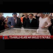
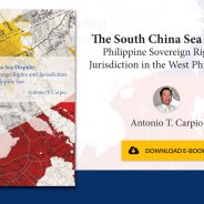
Carpio launches e-book challenging China’s sea claims
By Jim Gomez (Associated Press) | Updated May 5, 2017 – 8:07am From left, Philippine Supreme Court Senior Associate Justice Antonio Carpio, Mel Velasco Velarde and former Foreign Affairs Secretary Albert Del Rosario unveil the original copy of the 1734 Murillo-Velarde Map which shows the disputed Spratlys group of islands and the Scarborough Shoal during the launching of his e-book titled “The South China Sea Dispute: Philippine Sovereign Rights and Jurisdiction in the West Philippine Sea” in the financial district of Makati city east of Manila, Philippines, Thursday, May 4, 2017. A Philippine Supreme Court justice launched a book on Thursday that questions China’s historic claims to most of the South China Sea and said he will distribute it online to try to overcome China’s censorship and reach its people. AP Photo/Bullit Marquez MANILA, Philippines — Supreme Court Senior Associate Justice Antonio Carpio launched a book on Thursday that questions China’s historic claims to most of the South China Sea and said he will distribute it online to try to overcome China’s censorship and reach its people. Carpio said his e-book can be downloaded for free in English now and will be made available online later in Mandarin, Vietnamese, Bahasa, Japanese and Spanish to help more people understand the basis of the Philippines’ stand against China’s territorial claims. Carpio said public opinion, including in China, can help pressure Beijing to comply with an arbitration ruling last year that invalidated China’s historic claims based on a 1982 maritime treaty. Carpio helped prepare the arbitration case, which the Philippines largely won. China has dismissed the ruling and continued to develop seven artificial islands in the South China Sea’s Spratly archipelago. China’s construction of the islands on disputed reefs has alarmed rival claimants and the United States. “This book in its printed form can never be distributed in China. It will be banned,” Carpio said at the launch of his book in Manila late Thursday. “The only way this e-book can reach the Chinese people is in electronic format through the internet.” “I believe that like all other people of the world, the Chinese people are inherently good but their government has drilled into their minds that they own the South China Sea since 2000 years ago. This is, of course, utterly false and the world will never accept this,” he said. Chinese Embassy officials were not immediately available for comment. In the book, titled “The South China Sea Dispute: Philippine Sovereign Rights and Jurisdiction in the West Philippine Sea,” Carpio uses old maps, photographs, excerpts from the arbitration ruling, Chinese government statements and documents to question the validity of China’s claims. Carpio’s studies on the South China Sea disputes are not part of his work on the Supreme Court. He said he asked the court’s permission in 2015 to give lectures in 17 countries to explain the territorial conflicts, which many fear could become Asia’s next flashpoint. Carpio warns in the book that China may be planning to build more island outposts at Luconia Shoal off Malaysia and Scarborough Shoal off the northwestern Philippines to protect its economic and security interests in the region. If it constructs an island base at Scarborough, China would have enough radar coverage of the South China Sea to be able to impose an air defense...
read moreThe South China Sea Dispute: Philippine Sovereign Rights and Jurisdiction in the West Philippine Sea
DOWNLOAD E-BOOK INTERACTIVE DOWNLOAD E-BOOK NON-INTERACTIVE Share this:TweetShare on...
read moreMOTHER OF ALL PHILIPPINE MAPS

22 February 2017 10:13:39 AM A replica of the Carta Hydrographica y Chorographica de las Yslas Filipinas Manila 1734, otherwise known as the Murillo-Velarde Map, was turned over to the House of Representatives by Mel V. Velarde, Chairman of the Asian Institute of Journalism and Communication (AIJC). According to Velarde, Speaker Pantaleon D. Alvarez was chosen as the first official recipient of the historical scientific map because he heads the institution where around 300 congressional district representatives are gathered. In return, the Speaker promised to proudly display the piece in the House premises and to encourage his colleagues to support efforts that will instill intense love of country, especially among schoolchildren. Similar replicas will be donated to other government offices, including the Senate, Supreme Court and Executive Departments. The artifact was acquired in November 2014 through an auction conducted by Sotheby’s Auction House in the United Kingdom. “This historic map is part of every Filipino’s birthright”, Velarde said. source: http://www.congress.gov.ph/photojournal/zoom.php?photoid=1152 Share this:TweetShare on...
read moreOld map shows Panatag in PH territory

The Armed Forces of the Philippines Northern Luzon Command yesterday received a replica of a centuries-old map showing Panatag or Scarborough Shoal as part of the Philippine territory. A framed replica of the 282-year-old 1734 Murillo Velarde Map of the Philippine Archipelago was handed over by businessman Mel Velarde to Lt. Gen. Romeo T. Tanalgo, AFP Nolcom commander. Velarde is president and chief executive officer of Now Corp. and chairman of the board, Asian Institute of Journalism and Communication. Originally known as “Carta Hydrographica y Chorographica de las Filipinas,” the map was drawn by the Jesuit Fr. Pedro Murillo Velarde (1696-1753). It was the first and internationally recognized scientific map of the Philippines that was published in Manila in 1734 showing the disputed Scarborough Shoal also known as “Bajo de Masinloc” being part of Philippine territory as far back as three centuries ago. The map was used by the Philippines to support its case against China before the United Nations arbitral court. It locates the Scarborough Shoal, then known “Panacot Island” and was later called “Panatag” by Filipinos, off the shores of Luzon, then known as Nueva Castilla. In 2012, however, China gained control of the Scarborough following a standoff with Philippine vessels. Since then, the Chinese has been driving away Filipino fishermen from the shoal, which used to be their traditional fishing ground. In his message during a ceremony at the Nolcom headquarters in Tarlac City, Velarde emphasized the significance of donating the replica of the Murillo Velarde map to the AFP unit primarily tasked to protect the country’s maritime domain in the northern frontier, including the Scarborough Shoal. “Why is the replica of the Murillo Map being donated at Northern Luzon Command? The Northern Luzon Command is the protector, watcher, caretaker, defender of Bajo de Masinloc under Northern Luzon Command’s direct jurisdiction,” Velarde said. Tanalgo lauded Velarde for his patriotic donation of a framed replica of the 1734 Murillo Map to Nolcom. “Mr. Velarde’s exhibited act of patriotism is unique and unmatched . . . ensuring the 1734 map landed in the hands of Filipino people… And we are lucky to be the first (to receive) among the institutions,” Tanalgo said. He said the map will serve as a reminder to the Nolcom and all other operating command that will be receive the same that “Scarborough Shoal is ours.” “Today’s activity implores the spirit of “bayanihan” among all of us in terms of securing our national sovereignty and protecting national interest. In times like this, every patriotic act matters,” said the AFP Nolcom commander. (Elena L. Aben) Source: http://tempo.com.ph/2016/06/07/old-map-shows-panatag-in-ph-territory Share this:TweetShare on...
read moreAs defenders of Scarborough Shoal, Nolcom gets replica of 1734 Murillo Map
A businessman on Monday donated a framed replica of the 1734 Murillo Map that showed Scarborough Shoal as part of the Philippine archipelago to the orthern Luzon Command (Nolcom) of the Armed Forces of the Philippines (AFP). The replica was turned over by Mel Velarde to NoLCom commander Lt. Gen. Romeo Tanalgo at Camp Aquino in Tarlac City. Tanalgo also received donated copies of the map to be distributed to Nolcom field units. In his message, Velarde stressed the significance of donating the Murillo Map replica to Nolcom. “Why is the replica of the Murillo Map being donated at Northern Luzon Command? The Northern Luzon Command is the protector, watcher, caretaker, defender of Bajo de Masinloc under Northern Luzon Command’s direct jurisdiction,” he said. Scarborough Shoal, also known as Bajo de Masinloc or Panatag Shoal, is now under the control of China as tensions in the disputed West Philippine Sea intensify. The Philippine government used the Murillo Map when it filed an arbitration case against China before the Permanent Court of Aribtration in The Hague, Netherlands. The map shows that the disputed shoal is within the Philippine territory over three centuries ago. The Murillo Map, also known as “Carta Hydrographica y Chorographica de las Filipinas,” was drawn by Jesuit priest Pedro Murillo Velarde and was published in Manila in 1734. It is the first internationally recognized scientific map of the Philippines. Velarde acquired the map for £170,500 or around P12 million through a bidding put up by Sotheby’s for British lord, Ralph Goerge Algeron Percy, the Duke of Northumberland in November 2014 in London. He was urged to make sure the map goes to Filipino hands by Supreme Court Justice Antonio Carpio. Tanalgo, meanwhile, lauded Velarde’s initiatives. “Mr Velarde, the exhibited act of patriotism is unique and unmatched. Ensuring the 1734 map landed in the hands of Filipino people… And we are lucky to be the first (to receive) among the institutions,” he said. —Trisha Macas/KBK, GMA News Source: http://www.gmanetwork.com/news/story/568958/news/nation/as-defenders-of-scarborough-shoal-nolcom-gets-replica-of-1734-murillo-map Share this:TweetShare on...
read moreSoldiers get replica of 1734 map debunking China’s claims

‘SCARBOROUGH IS OURS.’ The Northern Luzon Command on June 6, 2016, receives a framed replica of the 1734 Murillo Map that shows the disputed Panatag Shoal (Scarborough Shoal) as part of the Philippines. Photo courtesy of Northern Luzon Command MANILA, Philippine – Soldiers in the northern part of the Philippines received on Monday, June 6, a framed replica of a 280-year-old map often used to debunk China’s claims over the West Philippine Sea (South China Sea). The replica of the 1734 Murillo Map of the Philippines was donated by businessman Mel Velarde, president of Now Corporation and chairperson of the Asian Institute of Journalism and Communication. Velarde gave the replica to the Northern Luzon Command (Nolcom) of the Armed Forces of the Philippines. The 1734 Murillo Map shows that the disputed Panatag Shoal (Scarborough Shoal), also known as Bajo de Masinloc, has been part of the Philippines from as far back as nearly 3 centuries ago. Panatag Shoal is found in the contested West Philippine Sea. (READ: Duterte: We will never surrender Scarborough) A standoff between the Philippines and China in Panatag Shoal in April 2012 prompted Manila to file a historic case against Beijing. The case is pending before an arbitral tribunal at the Permanent Court of Arbitration in The Hague, Netherlands. The tribunal is expected to issue a ruling any time soon. (READ: PH urged to build ‘int’l consensus’ amid China defiance) ‘Scarborough Shoal is ours’ Velarde said on Monday: “Why is the replica of the Murillo Map being donated to the Northern Luzon Command? The Northern Luzon Command is the protector, watcher, caretaker, defender of Bajo de Masinloc under Northern Luzon Command’s direct jurisdiction.” The map was drawn by a Spanish Jesuit priest, Father Pedro Murillo Velarde. Published in Manila, it is the first “internationally recognized scientific map of the Philippines,” Nolcom said in a statement. Nolcom commander Lieutenant General Romeo Tanalgo, for his part, praised Velarde for donating a replica of the map to them. Tanalgo said it is a “unique and unmatched” act of patriotism to make sure that the map “landed in the hands of Filipino people.” Nolcom said the 1734 Murillo Map will always remind them “that Scarborough Shoal is ours.” In his lectures, Senior Associate Justice Antonio Carpio of the Philippine Supreme Court has used ancient maps to debunk China’s claim over the West Philippine Sea. Carpio has said even China’s ancient maps dating back to 960 AD show that its territory “never included” the Spratly Islands and Scarborough Shoal in the West Philippine Sea. – Rappler.com Source: http://www.intellasia.net/china-and-philippines-diplomatic-row-ignited-after-old-map-found-washed-up-under-newcastle-housing-estate-2-449610 Share this:TweetShare on...
read moreXiao Time MURILLO VELARDE MAP ANG UNANG MAPANG SIYENTIPIKO SA PILIPINAS
Share this:TweetShare on...
read more