

 The government will submit a 300-year-old map of the Philippines to a United Nations arbitral tribunal to support its petition to nullify China’s claim to Philippine territory in the South China Sea.
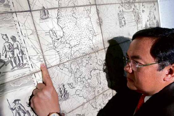
Published in Manila by the Jesuit friar Pedro Murillo Velarde in 1734, the map shows Panatag Shoal (Scarborough Shoal), off the coast of Zambales province, as part of the Philippines.
China seized Panatag Shoal, also known as Bajo de Masinloc, after a two-month standoff between Chinese and Philippine coast guard vessels in 2012.
Without military muscle to retake the shoal, the Philippines went to the International Tribunal for the Law of the Sea (It…
Keep on reading: To support claim, PH to submit 1734 map
Full story here: To support claim, PH to submit 1734 map