Pages Menu
TwitterFacebook
Categories Menu

News & Updates

Philippine Stock Exchange, Inc Map turn Over

Posted by on Jan 31, 2019 in Blog | Comments Off on Philippine Stock Exchange, Inc Map turn Over

Philippine Stock Exchange, Inc Map turn Over

Share this:TweetShare on...

read more

PAGCOR map turn over

Posted by on Jan 23, 2019 in Blog | Comments Off on PAGCOR map turn over

PAGCOR map turn over

Share this:TweetShare on...

read more

Australlian Embassy Map Turn Over

Posted by on Dec 14, 2018 in Blog | Comments Off on Australlian Embassy Map Turn Over

Australlian Embassy Map Turn Over

Share this:TweetShare on...

read more

Map rights wrongs: The 1734 Murillo Velarde map

Posted by on Oct 1, 2018 in Blog | Comments Off on Map rights wrongs: The 1734 Murillo Velarde map

Map rights wrongs: The 1734 Murillo Velarde map

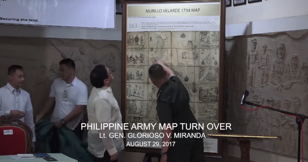
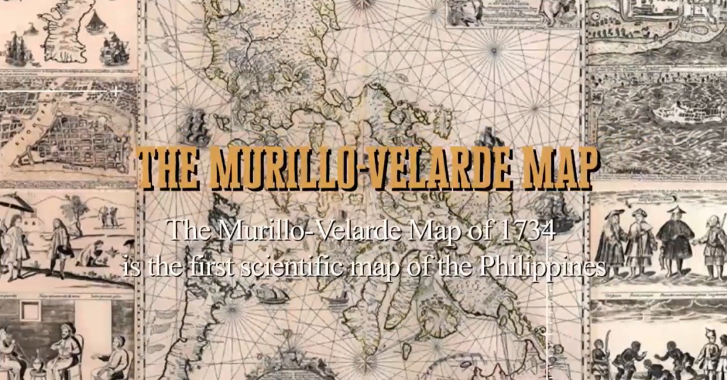
China never controlled the South China Sea (West Philippine Sea) at any time in history, as proven by the 1734 Murillo Velarde map.   According to Supreme Court Associate Justice Antonio Carpio, the map invalidates China’s Nine-Dashed Line and claims of ownership of the South China Sea for over “2,000 years. Carpio delivered the keynote address at the opening of the 16th Philippine-Spanish Friendship Day Conference on Oct. 4 at the auditorium of the National Institute for Science and Mathematics Education Development (NISMED). The 2-day conference had the theme “Mapping Spaces and Identities in Spanish Colonial Philippines.” Official. Printed in Manila, the 1734 Murillo Velarde map by the Jesuit priest Pedro Murillo Velarde, was the Spanish government’s official map of its territories (both terrestrial and aquatic) in the Philippines. Called the mother of all Philippine maps and widely copied by Filipino and European cartographers, the map showed the maritime routes from Manila to Spain and Mexico and other Spanish territories to the New World, something very vital to the Galleon Trade, the first global trade by sea. According to the National Library of Spain, the map was drawn by Filipino Francisco Suarez and engraved by another Filipino, Nicolas dela Cruz Bagay. “The map is so detailed that when a magnifying glass is used, one can see all the towns and pueblos of the Philippines in 1734,” Carpio said. He was part of the team that argued before the Permanent Court of Arbitration (PCA) at The Hague in the Netherlands on the Philippines’ claim on the Sea. Included in the 1734 Murillo Velarde map are the Panacot shoal (Scarborough Shoal) and the Los Bajos de Paragua (Spratly Islands or Spratlys). It was one of the 270 ancient maps presented at the PCA hearings contesting China’s claim over the South China Sea (West Philippine Sea) that began in July 2015. Among the other maps presented were ancient maps of China  throughout the Chinese dynasties, Philippine ancient maps and maps of Southeast Asia and European maps of Asia. China’s historical claim that it owned the South China Sea since 2,000 years ago (ed: roughly around the time of the Han Dynasty which began from 206 BC – 220AD) was refuted by Carpio and the Philippine team of experts. He said none of the ancient maps showed that China owned the contentious waters nor the Spratly islands and the Scarborough Shoal. The ancient Chinese maps’ southernmost territory was Hainan. “China in its earliest dynasty, from the Song and fast forward to their last dynasty, the Qing dynasty, and all their maps uniformly show that their southernmost territory is Hainan. So we presented this to the Tribunal. If you superimpose all the maps from the Song to the Qing dynasty, to over almost a thousand years, the southernmost territory of China was Hainan,” he said. No historical claim. The Nine-Dashed Line is the demarcation line China used to claim the major part of the South China Sea. China maintains it owns any land or territory contained within the line. Among the territories claimed are the Spratlys and Scarborough shoal. The demarcation line was formerly 11 dashes. In his book “The South China Sea Dispute: Philippine Sovereign Rights and Jurisdiction in the West Philippine Sea,” Carpio explained that in December 1947, the “Kuomintang Government of China...

read more

Mobile Marine and Naval Centrum

Posted by on Sep 25, 2018 in Blog | Comments Off on Mobile Marine and Naval Centrum

Mobile Marine and Naval Centrum

Share this:TweetShare on...

read more

Highlights of International Conference on Cartography in Philippine History (May 23, 2018)

Posted by on Jun 22, 2018 in Featured | Comments Off on Highlights of International Conference on Cartography in Philippine History (May 23, 2018)

Highlights of International Conference on Cartography in Philippine History (May 23, 2018)

Share this:TweetShare on...

read more

Mel Velarde Speech at International Conference on Cartography in Philippine History, May 23, 2018

Posted by on Jun 21, 2018 in Blog, Featured | Comments Off on Mel Velarde Speech at International Conference on Cartography in Philippine History, May 23, 2018

Mel Velarde Speech at International Conference on Cartography in Philippine History, May 23, 2018

Share this:TweetShare on...

read more

Indian Ambassador map turn over

Posted by on May 9, 2018 in Blog | Comments Off on Indian Ambassador map turn over

Indian Ambassador map turn over

Share this:TweetShare on...

read more

UK ambassador map turn over

Posted by on Feb 22, 2018 in Blog | Comments Off on UK ambassador map turn over

UK ambassador map turn over

Share this:TweetShare on...

read more

PNP map turn over

Posted by on Feb 22, 2018 in Blog, Featured | Comments Off on PNP map turn over

PNP map turn over

Share this:TweetShare on...

read more